The map and BLUFOR tracker cTab provides has a pretty nifty feature: With just a couple of clicks, detailed information about known enemy forces can be made available to all friendly forces with tablets or phones. This feature is called Enemy SALUTE and in this guide you will learn how to easily and accurately use it.
What is a SALUTE?
SALUTE is an acronym designed to make it easier for soldiers in the field to remember the information they are to convey when reporting enemies they have spotted. This is what it means:
- Size
- Activity
- Location
- Unit
- Time
- Equipment
How do we use it?
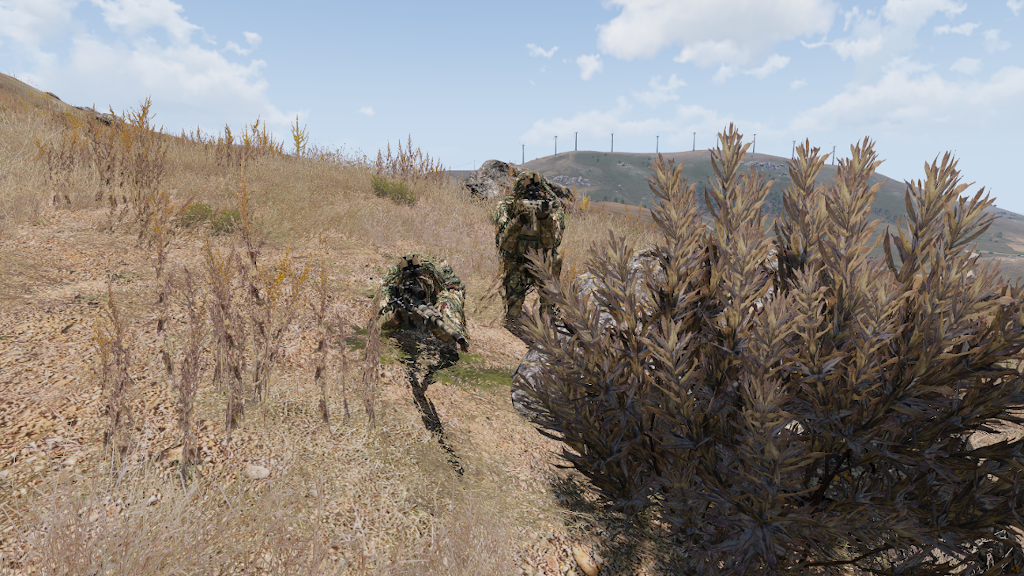
In cTab, we can put (most of) this information into the BLUFOR tracker, but first we need to identify our enemy and their location on the map. This is where a rangefinder or laser designator comes in handy. By clicking the left mouse button, you get a display of the azimuth (AZT) and range (RNG) to the target.

This data is required to accurately add the enemy position to our tracker map. In order to put it in, we open cTab, open the BLUFOR tracker map and find the location by moving our cursor over the map until azimuth and range on the bottom right line up with our rangefinder reading. Once you have the location down, double click the map.
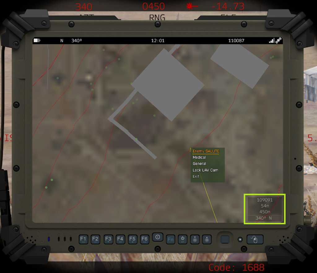
A context menu opens up. As you have probably guessed, we want to click Enemy SALUTE. Now we can follow through the set of menus to accurately describe the enemy we have spotted:
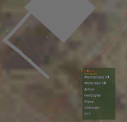
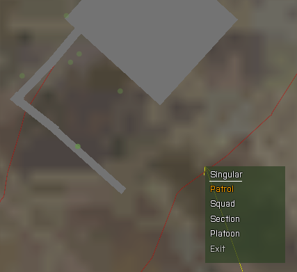
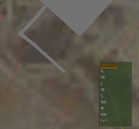
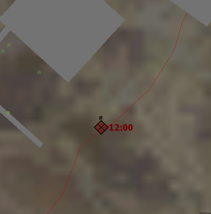
The first menu asks for the type of enemy. Then, you select the number of enemies spotted. Last but not least you state the direction the enemy is travelling in. In our example, we have spotted a two man sentry, so we select “Infantry”, then “Patrol” (which is 2-4 soldiers), then “Stationary”. The resulting marker is a NATO notation marker with a diamond and cross signalling OPFOR infantry, a dashed circle indicating a smaller than squad size element, and a timestamp when the marker was created. The latter is immensely useful to friendly elements when they want to gauge the position of a travelling enemy element or when wondering whether the marker is still up to date.
Now, let’s pretend we have spotted a squad of enemy infantry moving towards the location of our original sentries, currently located to the North West. We click “Infantry”, then “Squad”, then “SE” as they are moving South East. This is how the resulting symbol looks on the map:
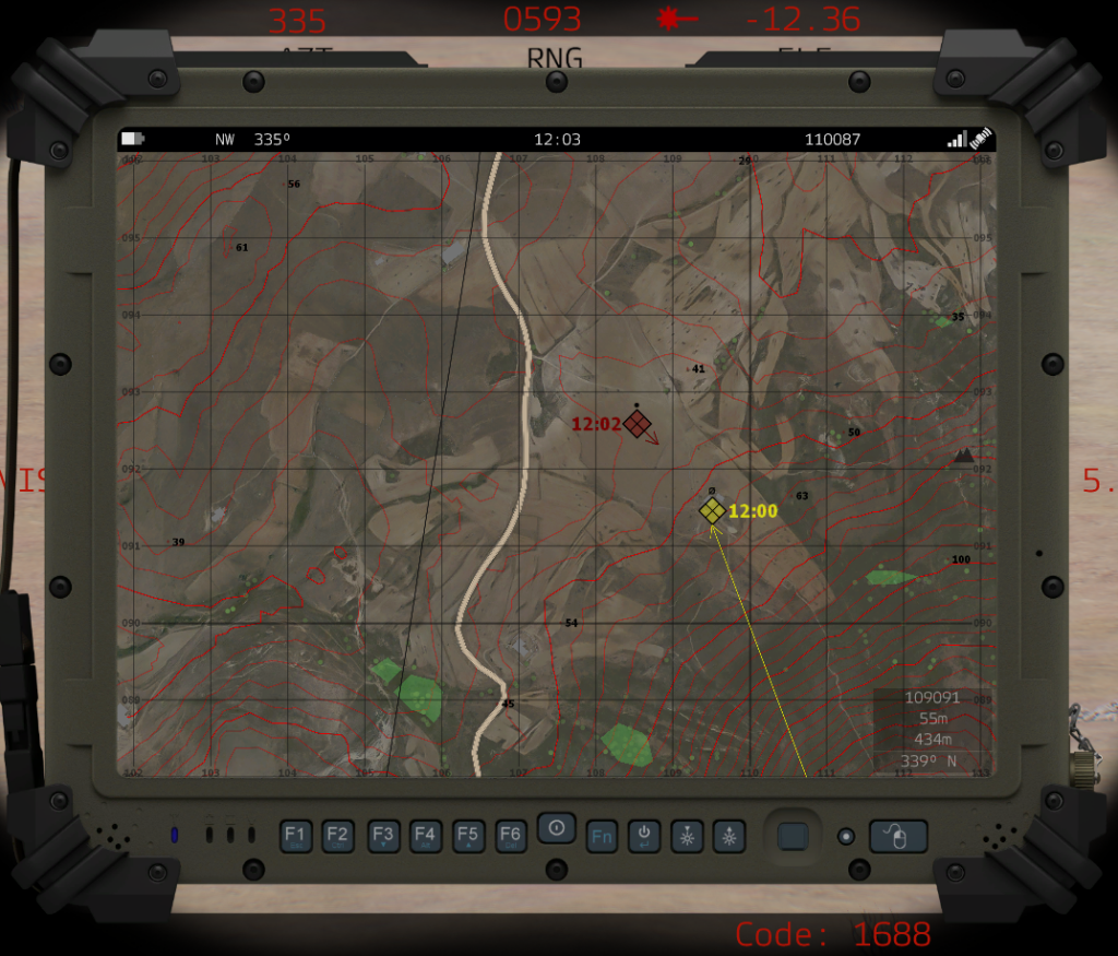
The crossed Diamond means OPFOR Infantry as we know, the single dot means “Squad Sized” and the symbol has an arrow depicting the movement of the unit when it was spotted. A single glance on this map by any friendly element will be of immense help to them when operating in the area of operations. By the way, you can easily remove stale or inaccurate markers by hovering over them and pressing “DELETE” on the keyboard, akin to removing map markers on the Arma map.
Takeaway
Now you know everything you need to place accurate map markers for all friendly units on your cTab tablet. Using this feature to great extend enables a cohesive unit to assert the battlefield situation with precision and take the most advantageous actions; good intelligence will be invaluable for deciding the outcome of the operation.
Want to test your newly acquired skills in the field? Why don’t you check our calendar section and find an event with cTab in the mod list so you can give it a go while playing with a group of friendly and open Arma players of all experience levels? See you on the battlefield!
Guide and images are for the most recent version of cTab NSWDG edition at the time of writing.